


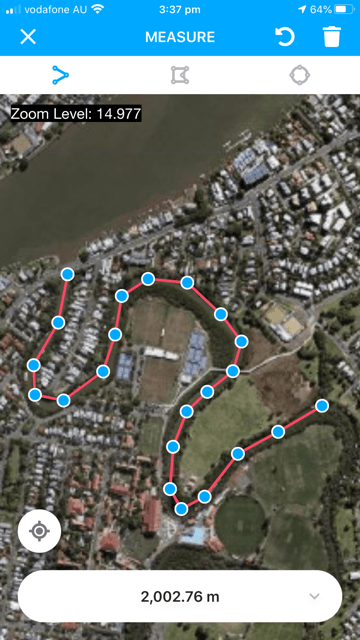
Distance along a path.
Now live in the Gruntify mobile app is the ability to easily measure distance and area in the field using the built-in maps. On the main map screen, click on the Options button to find the new Measure button.
The first Measure tool measures the distance along a line or route. Tap on the screen at the start of the line and then keep clicking along the route to make a series of joined dots.
Make your measurements in Feet, Yards, Miles, Meters, and Kilometers.
Changing units is easy! Click on the measurement shown at the bottom of the screen and choose your preferred units from a list.
You can change any time – no need to start the drawing over again. So if you start in Feet but Yards is better? Then start measuring, switch to Yards then keep measuring. Find at the end that you should have stuck to Feet? Switch back no problem.
The second Measure tool measures the area in an arbitrary shape. Again, it is as easy as clicking on each corner point (or vertex) of the area of interest, such as this rooftop.
The final Measure tool measures the area in a circle with two easy clicks: click in the center then click on the edge of the circle. A perfect circle will appear on the map.
Make your measurements in Square Feet, Square Yards, Square Miles, Acres, Square Meters, or Hectares.
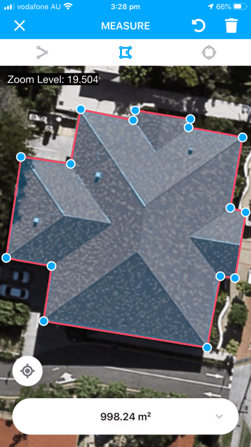
Area enclosed by a polygon.
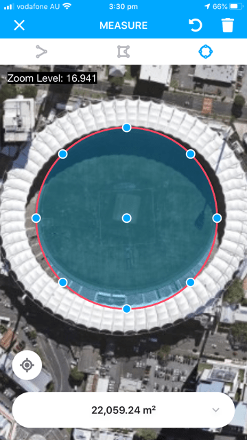
Area enclosed by a circle.