
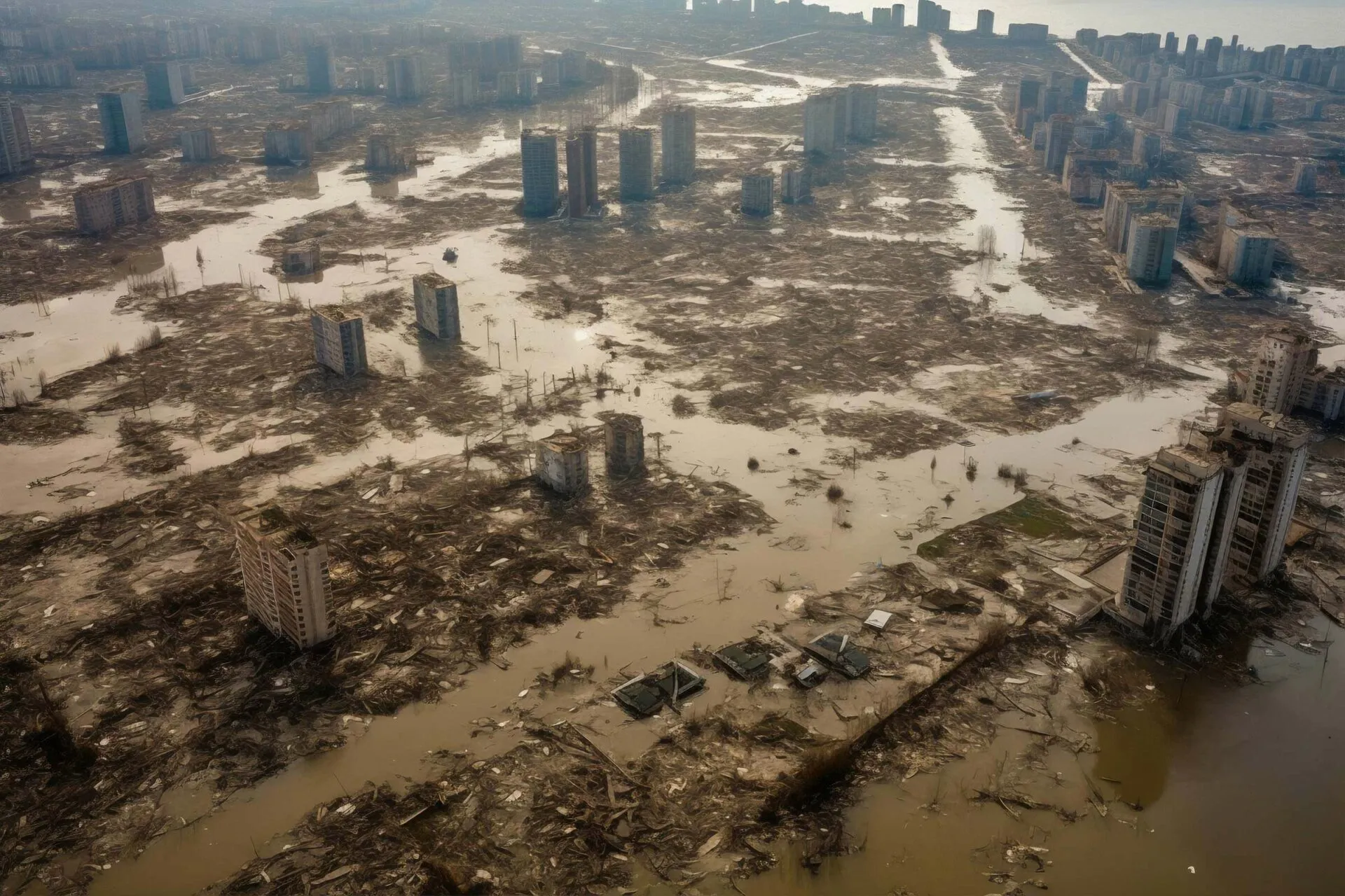
Emergency Management Software
Be prepared to react swiftly and save lives. Enhance emergency management with our intuitive software, optimizing planning, response, and disaster recovery efforts.

Rated 4.6 stars at Capterra
Emergency management &
response done better
In this digital age, satellites and artificial intelligence (AI) are revolutionizing field operations, enabling more efficient data flows and effective emergency management. From the command and control center to on-ground response, let’s explore how these technologies are shaping the way we tackle emergencies.
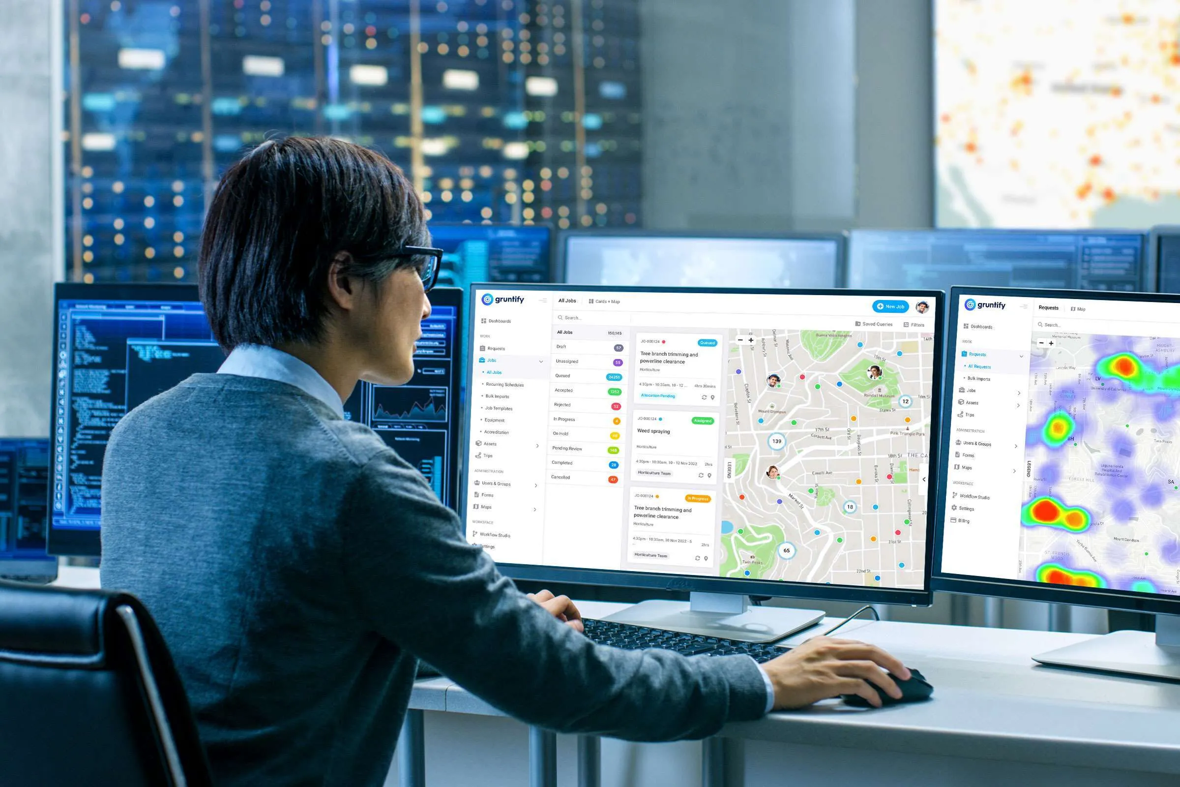
Unify emergency response & management with Gruntify's command & control center
At the heart of emergency management, the command and control center serves as the nerve center for decision-making. Visual technologies like interactive maps and Power BI reports provide real-time situational awareness to emergency management personnel. These tools offer comprehensive views of the affected areas, resource deployment, and critical information necessary for informed decision-making.
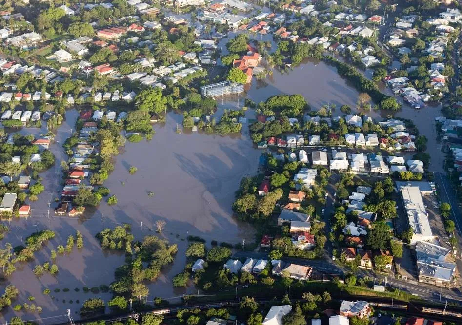
Break free from boundaries with advanced remote monitoring solutions
Satellites and drones play a crucial role in gathering essential information about disaster-affected regions. By capturing high-resolution images, they provide valuable before-and-after comparisons that help assess the extent of damage caused by events like floods. Interactive sliders allow viewers to seamlessly transition between images, revealing the stark contrast between pre- and post-disaster conditions.
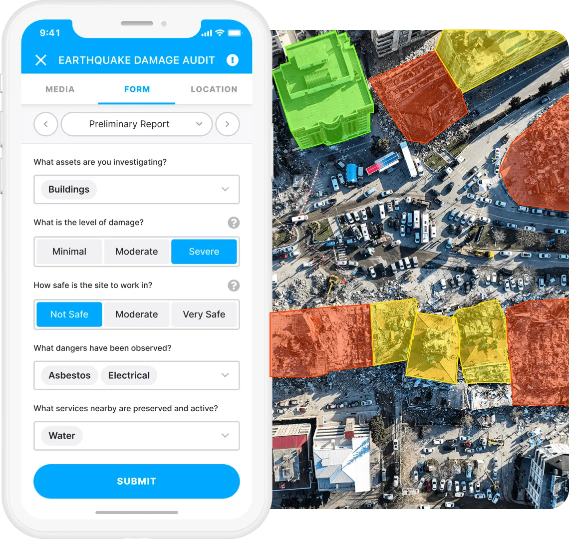
Harness the power of AI and ML for damage assessment
To expedite damage assessment, AI and machine learning (ML) algorithms are employed. These technologies analyze satellite and drone imagery to identify buildings, roads, and infrastructure affected by the disaster. By automating this process, emergency response teams can rapidly assess the scale of devastation and allocate resources accordingly, optimizing response efforts.
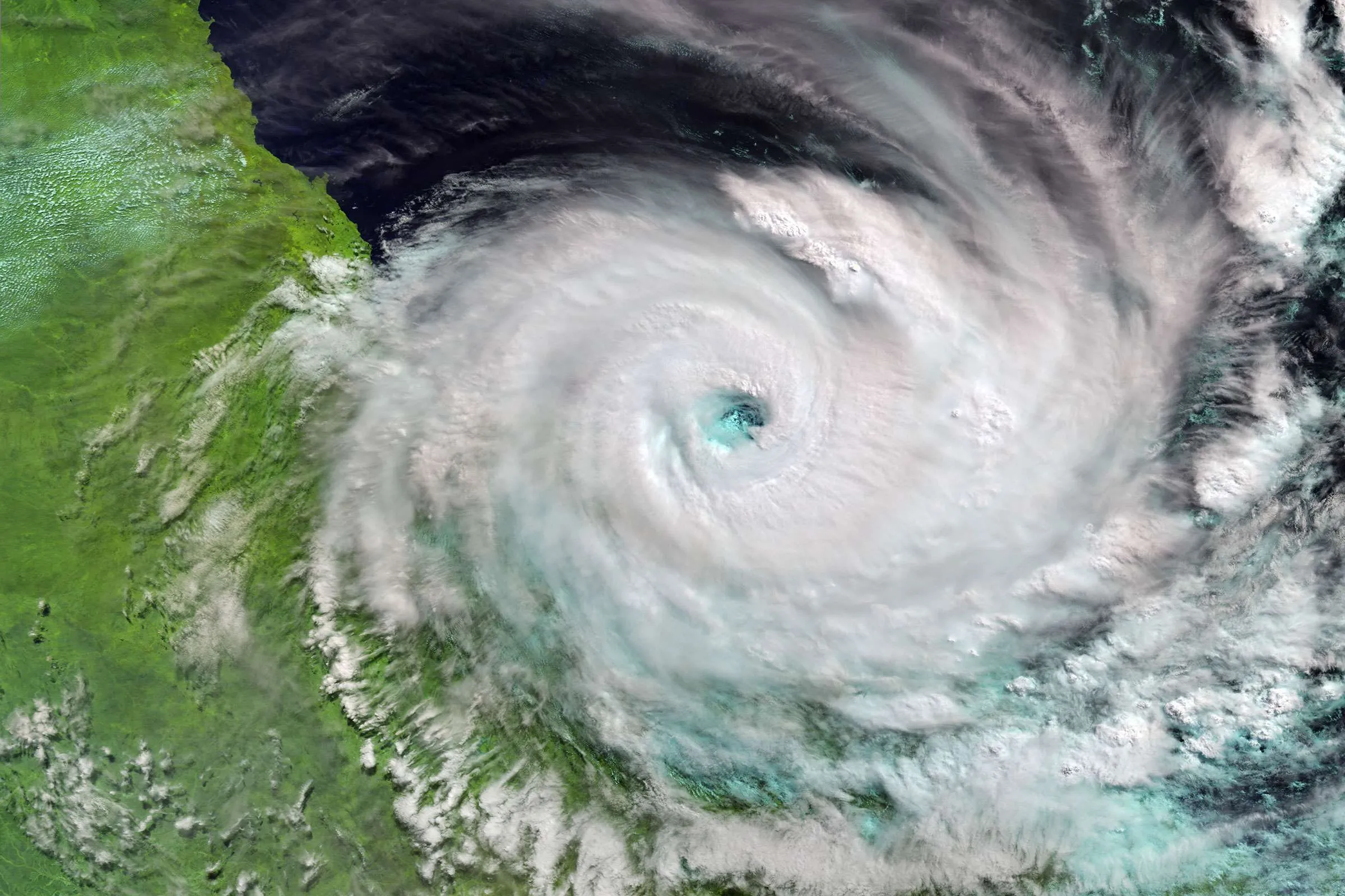
Gruntify used by government to aid emergency response & recovery process
In 2017 Cyclone Debbie ravaged large parts of the state of the Queensland, Australia. Gruntify was rapidly deployed by the Queensland Government throughout the state to help document damage to critical infrastructure and aid in the recovery process.
Watch Now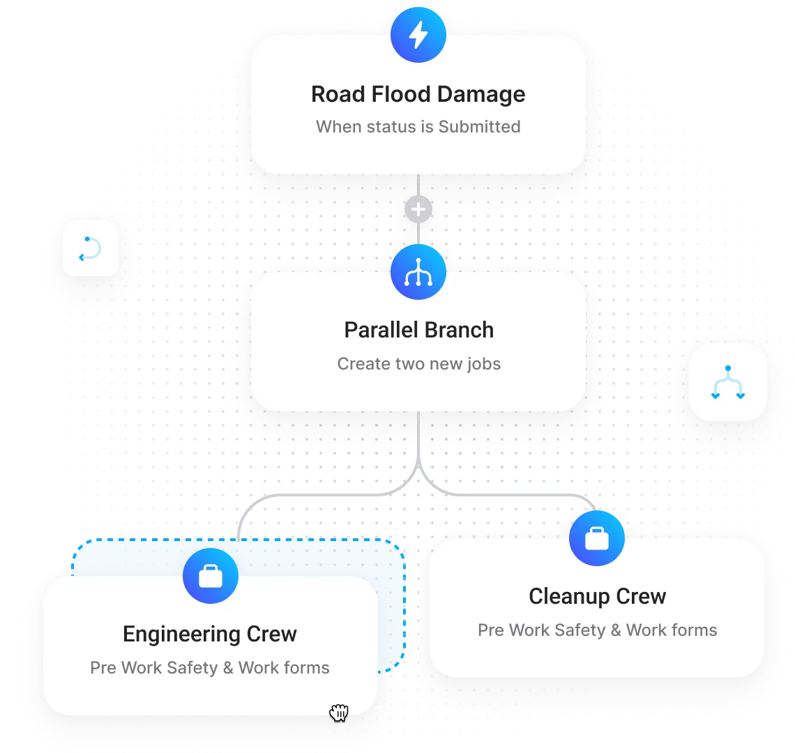
Streamline operations with automated dispatching of inspectors and crews
Leveraging the data gathered through satellite imagery and AI, emergency crews can be efficiently dispatched during the crisis. These crews, equipped with the necessary skills and resources, can monitor the situation on the ground, provide immediate assistance, and coordinate rescue operations. Additionally, damage inspectors can be deployed post-emergency to assess structural integrity, ensuring the safety of affected areas.

Build resilient futures with innovative reconstruction & monitoring solutions
During the reconstruction phase, AI-powered emergency management software aids in supervising and monitoring the progress of construction projects. Construction supervisors utilize satellite imagery and AI analysis to evaluate the restoration of infrastructure, ensuring compliance with safety standards and timely completion. This comprehensive approach facilitates efficient rehabilitation and minimizes further disruptions.
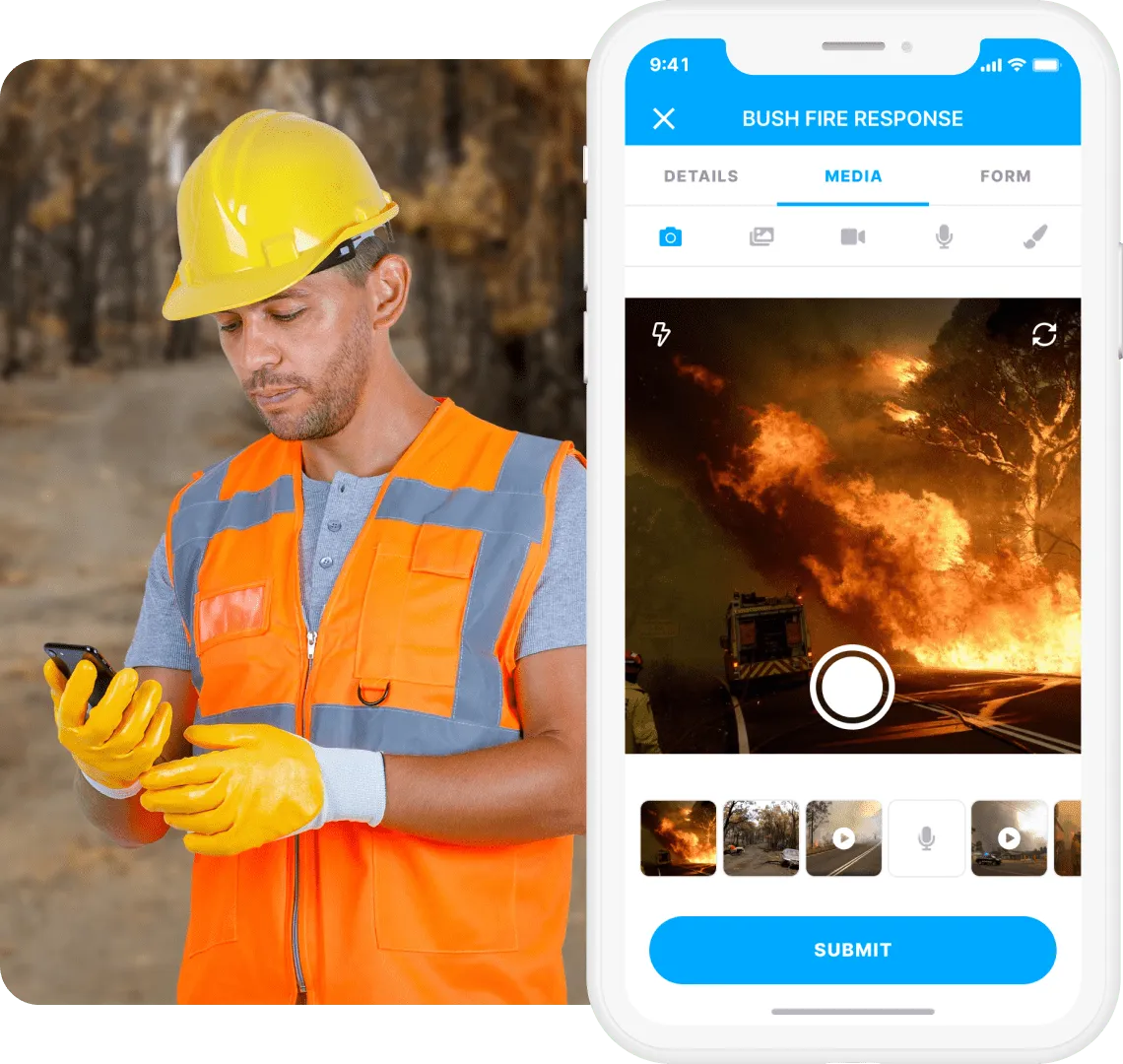
Leverage photo and video evidence for effective emergency management
Collecting accurate and timely evidence is crucial for effective reporting and decision-making when using emergency management software. By integrating photographic and video evidence with the emergency response workflow, stakeholders gain valuable insights into the ground situation. These records not only aid in post-event analysis but also serve as valuable references for future preparedness and response efforts.

“Has been transformational in helping us meet our digital initiatives internally, while providing our clients with seamless access to reporting and data.”
Everything you need for reliable emergency management
-
Smart forms
Build your own or customize one of our templates. Use conditional logic to create easy-to-fill smart forms.
-
Project workspaces
Set up workspaces for each of your projects to make teamwork easier, more focused, and more secure.
-
Geo-enabled inspections
Collect and analyse form & location data in real-time with the Gruntify Emergency Management Software.
-
Workflow automation
Set up actions that can be triggered in response to events or data submissions with the Grunt automation agents.
-
Workforce management
Track & manage users in real-time, record trips for proof of service and manage your team all in one platform.
-
Quality customer support
Get all the answers you need to get your software working according to your needs with a click of a button. Reach out to the help center and raise support tickets to have your issues or queries answered quickly.